
I have wanted to go to Erin Ijesa since I first heard about it during my early days in Nigeria. A waterfall with SEVEN levels you can hike? Yes please. I googled around to try to find pictures of the place, but barely found anything. I asked around to try to get a sense of how intense the hiking was or how big the waterfalls were, but most people had never hiked past the first or second. A few said the hiking was really intense, but since hiking isn't very common here (among people I know, anyhow), I wasn't sure how to judge that. Now that I have been, I wanted to write about it, in case others want to get a sense for the place before going.
We went on a Saturday in October, and it was still raining heavily most days. I obviously don't have any first-hand comparison, but from what others said (and what it seemed like to me) the waterfalls and rivers were full, and the place was really crowded. Even just walking up the path to the first waterfall, there was water coming onto the path, and flowing vigorously.

As I mentioned earlier, there are seven levels, each with a waterfall, and you can hike up the mountain to see each of them. There is a simple path to the first one, and it looks like this:


To get to the path to the second level, you have to cross through the river (as the guys behind me to the left in the above picture are doing) and then climb up steep rocks. It's not for the faint of heart, that is for sure. Nor those who have a problem getting dirty. It was muddy and wet, and I was using all my limbs to get me up. Here is a picture of the climb from below:

The climb is completely worth it because the second waterfall is the best, in my opinion. It's the biggest and most intense. And extremely beautiful. There were entirely too many people there for my liking (and mostly drunk college boys at that), but it was still striking:


Apparently most people stop there. The hike up to level two scares off a good number of people. Unless you really want to hike, it's definitely not conducive to any kind of casual approach. It turns out the people who told me the hiking was intense were right. Of the 40+ in our group, only 8 of us wanted to continue. Four guys and four girls, and all but two of us did it barefoot. I know, I know, Africans are used to being barefoot, but it was seriously impressive to me.
So the deal is that there is a main path you hike up (not altogether well marked, I might add, and none of us had done it before), and then at each "level" there is a path that branches off the main path, going back DOWN to the next waterfall. You climb up to the next level only to climb down to see the waterfall. Then back up to the main path to continue up to the next level. Thus, it's essentially double the hiking. At level 3 we didn't go all the way down, because it was REALLY far down, and we want to preserve our energy for the "long haul" and ensure we could get as high as possible. Here we are part of the way down the climb to level 3:

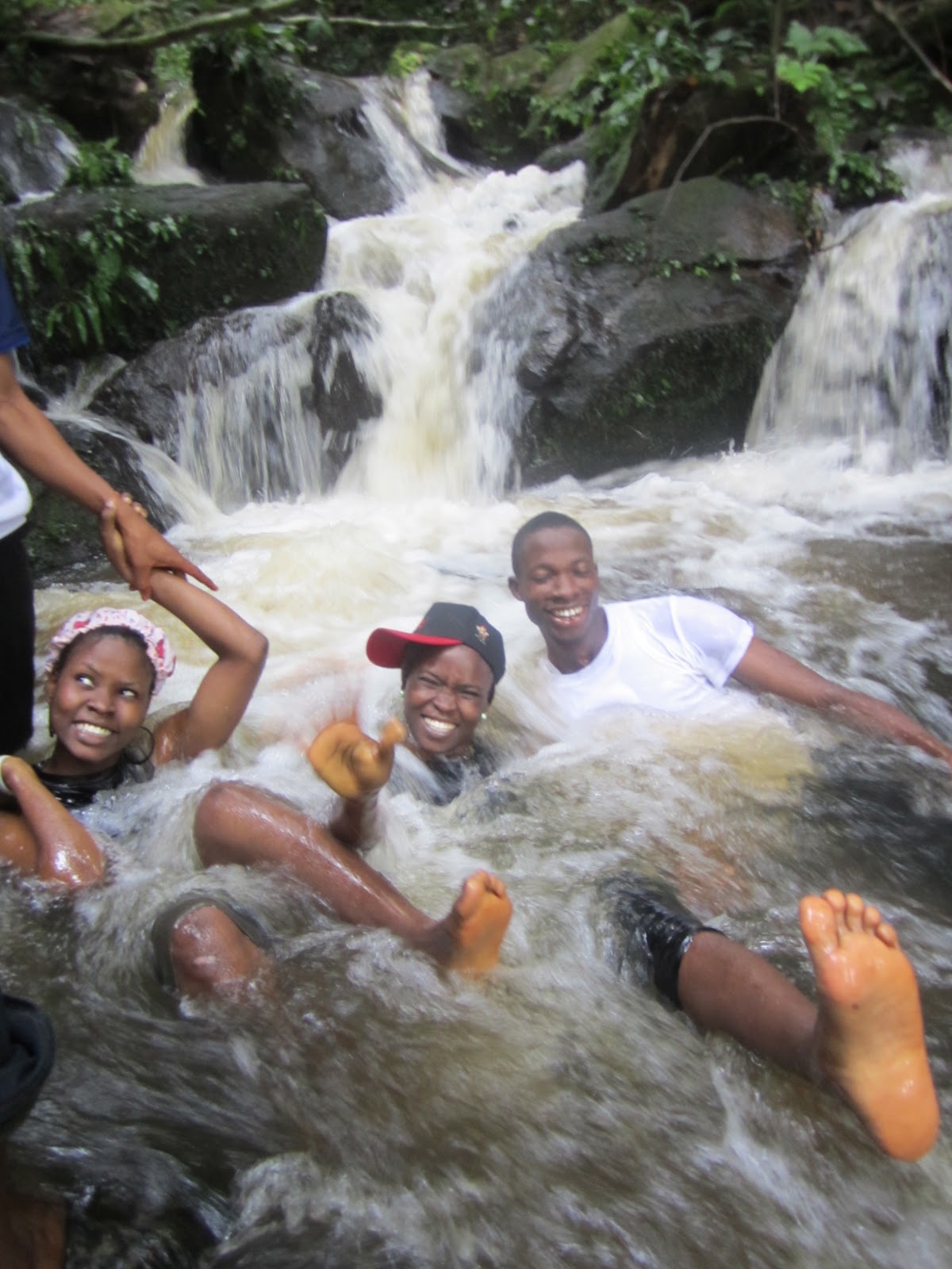
Level 4 was different, in that it was a smaller waterfall but still really powerful and beautiful. We hung out there for awhile playing in the water:

We continued hiking up and when we got to the path off to Level 5 continued upward. Several of us were set on getting to Level 7, but many of us were very tired by this point, and so we wanted to try to go as high as possible and not expend so much energy going all the way down to each waterfall. We came out one a more flat grassy area and walked along a path. It was 3pm and the sun was extremely hot. After a few minutes we met several people coming the opposite director who said they walked for an hour and saw nothing. We were slightly confused because we hadn't seen any paths for 6 or 7, but since we were clearly at the "top" of something and walking away from the water, we turned around and went back down. We also knew that there is a village at Level 7 (I was so intrigued!), and there was clearly no village. Thinking maybe the path to 6 and 7 was at Level 5, rather than off the main upward path, we headed back down to investigate. On the way I noticed an amazing view through the bush. I called to everyone to come take a look. We made our way through waist high grasses to see this:

And managed to find a perfectly positioned rock to take a picture all together:

Truly worth it!
Back down at Level 5 we found a total mess. Trees had fallen all across the river and there wasn't even really a waterfall that we could see:


I was also sore for about three days afterwards! If you have hiked past Level 5 before, please leave a comment sharing how you did it and where the path is. Erin Ijesa is a wonderful and beautiful spot, well worth a visit, and well worth the hike!
No comments:
Post a Comment